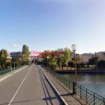
(GPS) 09 Camogli-Sestri L.
(Google Earth) 09 Camogli-Sastri L.
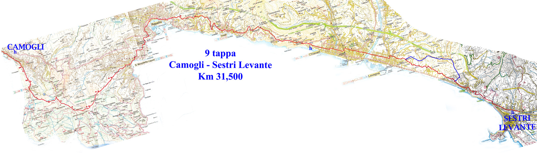
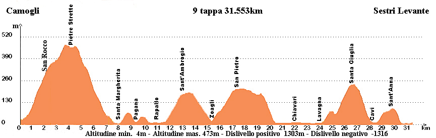
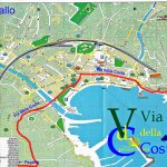
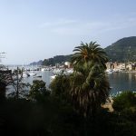
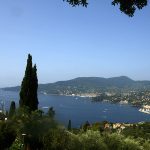
9° stage: Camogli – Sestri Levante 31,100km – Time: 8h15 – Difficulty: medium
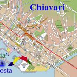
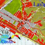
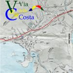
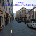
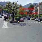
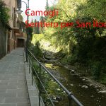
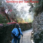
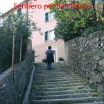
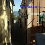
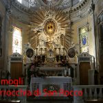
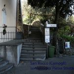
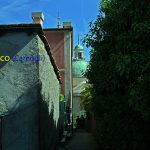
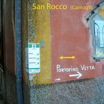
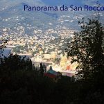
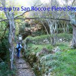
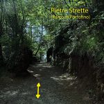
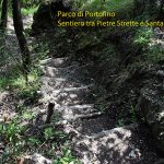
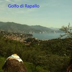
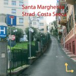
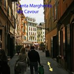
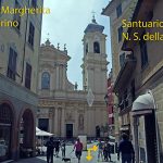
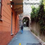
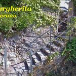
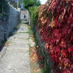
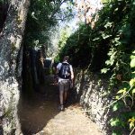
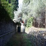
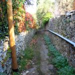
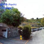
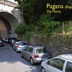
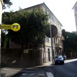
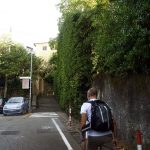
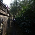
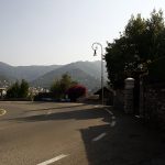
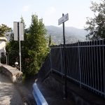
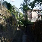
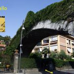
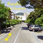
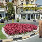
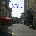
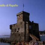
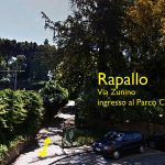
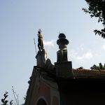
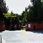
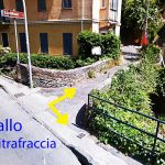
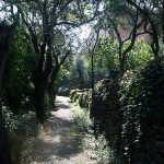
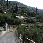
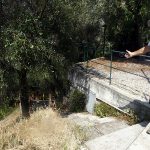
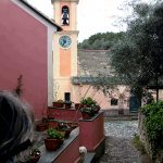
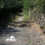
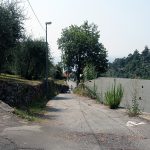
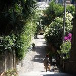
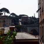
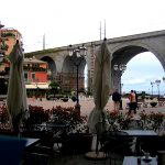
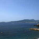
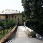
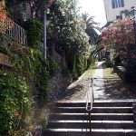
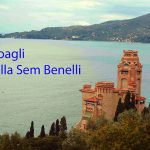
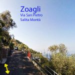
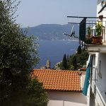
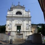
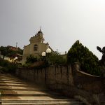
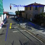
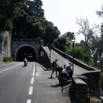
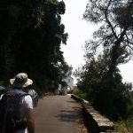
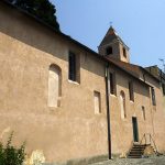
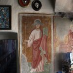
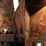
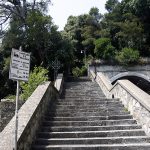
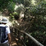
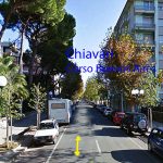
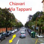
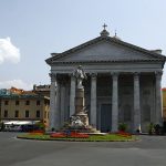
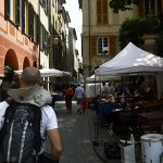
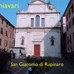
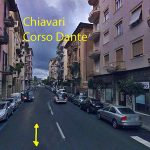
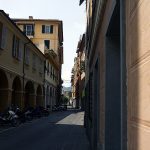
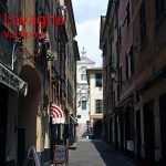
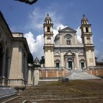
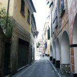
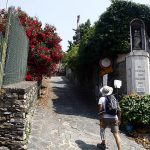
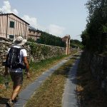
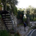
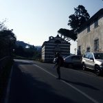
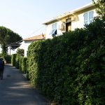
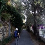
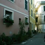
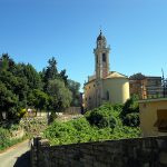
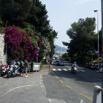
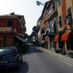
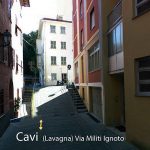
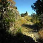
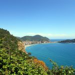
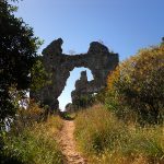
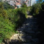
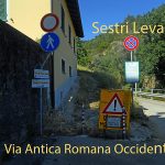
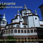
The journey begins at “Via della Repubblica” by the railway station of Camogli. At the fork we go down right in “Via Cuneo”, at the hairpin we continue rights in “Via S. Bartolomeo” that is a cemented path running along the river, we cross the little bridge and go up in “Via S. Rocco”: (road-signs: two red stamps). The path is a long, steep staircase that goes up among olive-trees and chestnut groves and country houses, we reach the church of S. Rocco, where we can enjoy beautiful views of the Gulf of Genoa and the coast of Portofino (fountain and food products). From here we take the path “Via Galletti”: (road-sign: empty red circle). Go along the apse of the church and continue on the cobbled path enriched by the Stations of the Cross and Mysteries of the Rosary: we can admire the splendid view of Camogli. The trail is all in the woods of chestnut and elm trees, we reach the fork with the dirt road that leads from Ruta, here we turn right then, after hundred meters, we continue on the left in the direction of “Pietre Strette” that is reached in a short time (road-sign: full red square). We take the direction to Santa Margherita: (road-signs: two full red rhombus). After 100m we leave the main road, turning on the left down a steep and narrow path indicated by road-signs: two full red rhombus. The path becomes a little easier later on, becoming a cobbled mule track immersed in a forest of chestnut, oak and arbutus trees, we arrive in “Via Costasecca” which we follow until we reach and surpass the hospital. Turn left in “Piazza del Comune”. Cross the square and turn right in “Via Palestro”; after reaching the Santa Margherita Church turn left following a short road stretch; cross “Via Roma” and move slightly on the right to join “Corso Doria”; at the “Nello Restourant” turn left in “Via Stazione”; take the underpass that, through the flight of steps, reaches “Via Fiume”; continue to the left in “Via Pellerano”, which continues through walls on a paved marked by long steps, at the first intersection continue straight uphill and at the next intersection turn right on the road narrows and plane. At the next intersection continue to the right slightly downhill at the height of a box of “Enel” No.1715 we turn left to a narrow lane between private stone walls. We go downhill, along “Via Donega”, in the village of San Michele di Pagana, we continue on “Via Meucci”, turn left along the main road to the post office to turn left on “Via Pitosforo” (first paved road then narrow flight of steps) we come to the “Piazzetta Costa“ continue on stairs, uphill on the path overlooking the bay, and then again turn right on a nice flat path between villas and gardens. We reach the “Via Aurelia Ponente”, immediately thereafter bend turn right in “Via Ponte Annibale“, go down a flight of steps and then, through a narrow road, we reach the roman bridge said of Annibale in Rapallo. We arrive in “Via A. Moro”, cross the bridge, we continues rights in “Via Marco Polo“, then in “Via A. Gramsci“. Cross “Via A. Giustiniani“, turn right and immediately later turn left in “Via Cairoli“ just crossed the arc of the city door and joints in “Via Mazzini“ turn right, we reach “Piazza Pastene”, then cross into “Lungomare Castello” pedestrian; isolated a few steps from the shore we can admire the Castelletto di Rapallo of 1500. We continue moving to the left in “Via Zunino“, when we reach a hairpin bend continue straight on moving to the left on a walkway on a slight slope into the city park of the “Villa Porticciolo”; immediately we turn to left into a treelined avenue, pass on the left the small church of San Rocco and reach immdiately after the park gate, then we cross “Via Aurelia di Levante”. Continuing, to take “Via Pietrafraccia” that we leave on the right across a small stone bridge with indication “S. Ambrogio”. Through an uphill with the same name, (a staircase on the left reaches the church square from which we can have a sight across all the Gulf: two majestic oaks frame the view, fountain) arrived in “Via Liggia”continue straight on and immediately after the crossroad go rigth in “Via Ezra Pound”; after many curves the paved road continues and arrives through a stairway to the height of the restaurant “Ca’del Frate” in “Via Cornice di Sant’Ambrogio”, where we can see “villa rosa” where Ezra Pound live; before reaching the S. Pantaleo Church, take on the left a small road, the trail continues downhill, the after about 50 mt on a hairpin curve goes right in “Via Mauro E. Scauro“, to Zoagli; after reaching a road turn left to join the “Via Aurelia“, where is the tunnel on the main road. We continue down through the “Via Aurelia” and then we leave it, taking a right “Via Antica Romana“ that ends with a staircase that leads on the square of Zoagli. From here we head east on “Via Garibaldi”, which begins with a flight of stairs made with slabs, bricks and stones, we go under the railway to reach a small open space and continue on a paved road uphill, then a staircase leads to “Via Aurelia” turning right, we walk we cross, then we take a left stairway with direction S. Pietro. We go up among villas and gardens, walking upon a paved road, then we reach and follow it admiring the unique villa by Sem Benelli, built in 1912 by the playwright and Villa Cordani home of a famous textile center. This road has little traffic and is surrounded by olive groves. We can reach on a bend the “Rio Rico”, here divided into two branches that are crossing by two bridges and after 50m we take on the left the pedestrian “Salita Montà”, which leads to the church of San Pietro. (fountain). We pass on the left the cemetery and just after it we find the church of Sant’Andrea in Rovereto. It is a beautiful road with many holiday homes, a particular one is “The Pousada das Oliveiras” decorated with delicate blue and white tiles (clearly reminiscent of Portugal). After 1km we will reach the “Via Aurelia” downhill, cross it at the traffic lights and continue towards the east with a lot attenction then we leave it, before the tunnel on the right, to reach the Sanctuary of the Madonna delle Grazie (worth a stop for the valuable internal frescoes, note in the small chapel of the Annunciazione fresco of the XVI century a little hidden of Saint James). We go ahead and taking a staircase, we reach again the”Via Aurelia”, but do not go along it, turn sharply to the right back on a trail and after 20 meters on an open area, do not go straight on, but turn left down the forest. After several switchbacks we reach the tree-lined “Corso Buenos Aires“, then “Piazza Porta Torriglia“: crossing it diagonally to the left, we enter in “Viale F. Tappani“ and in “Viale N.Arata“, we arrive at the Cathedral of “Nostra Signora dell’Orto”: we are in the center of Chiavari. We turn left and take “Via della Cittadella”, we turn right on the square and take “Via Rivarola“, “Piazza Matteotti“, we move on the left and take “Via V. Veneto“, “Corso Dante“, “Piazza Cavour“, then we take again “Corso Dante“ and crossing the “river Entella”, we arrive in Lavagna. We continue in “Corso Buenos Aires“, “Piazza Conte S.Cordeviola“, “Via Cavour“, and arrived in “Piazza V.Veneto“ si svolta a sx in “Via Roma“, we turn left on “Via Roma“, reaching the valuable square of the “Parrocchia di Santo Stefano”. We turn right into “Via Dante”, then we move to the right to reach “Via Sanguineti”,”Via Tedisio” and slightly uphill, we turn left at the fork where is located a religios votive pilar with” Madonna” go up along the paved road “Via Monte”: (road-sign: red stamp), direction of Santa Giulia. The climb is steep between walls and homes, we reach a large gate civic number 4 in front of the aqueduct (*) we continue straight on asphalt downhill towards Cavi di Lavagna, keep left at the stop sign and immediately after cornering at a iron ladder take in dirt path on the left, we take the paved road without sidewalk, on the right there is the “Camping Ripamare”, continue with attenction to the “Camping Lo Scoglio” and reach the Chapel of Famiglia Sivori; at the stop sign continue left in Via Tigula, continue for about 900m, instead of taking on the right the “Via Romana”, which is interrupted by a landslide, continue slightly uphill on the left in “Via della Pineta” and after about 400m. turn right on the staircase, after 100m passing a small porch, ( ) we go left on “Via Romana”: after 100m we reach the church of the Immaculate Conception in Cavi di Lavagna. Go ahead and reach “Via Aurelia“, then turn left into “Via Brigate Partigiane”, turn left immediately in “Via San Leonardo“ and still to right in “Via Milite Ignoto“ we climb a wide stairway then continue rights up to take on the left the “scalinata pedonale Sant’Anna” in slope right reaching the ruins of St. Anna (the path is the ancient Via Aurelia). We continue downhill and after several turns we get on the main road that goes to the right of the railway: we are in “Via Antica Romana Occidentale”, after about 1km we arrive to the hospitality at Sestri Levante.
large gate n 4-Santa Giulia Cavi Salita Centaura km 3,300
(*)…continue uphill on the left in “Salita San Benedetto” on a path with regular cobbled stone and slabs on the sides for about 200m , the we turn on the right on the asphalt and flat road and after about 500m arrived near a pink house leave the asphalt to turn right on stairs, then we cross the road to “ristorante Il Gabbiano” and continue through the olive groves on the steep climb pedestrian road. We reach and pass the votive pilar then go up until we pass the main roadIl to take the stairs leading to the square of Santa Giulia (St. Jacob), which offers breathtaking views of the Tigullio. From the square we go down to the east on the paved road, leaving it on the right for a path; then we take again the road that runs for about 80m, on the curve, after that we arrive again in the straight path that goes down, the trail is paved, we pass by the ruins of chapel of Santa Cecilia, cross the road which runs left for a short distance, then take the path again, past “Villa Ravano”, then to the fork turn sharply to the right, descending steeply up stairs, cross the asphalt road and continue straight on; coming on asphalt and to the civic No. 3 of “Salita Centaura” ( )
Hospitality:
Leivi (Ge): the locality is off track to reach by bus – “Sorelle Povere di Santa Chiara” (R) – Via 1° Maggio, 26 – notice is necessary – Credential obligatory – apply the Mother Chiara Gioia – Phone +0390185319689 – donative.
Chiavari: Ostello Aig “Camping al Mare” (L) – Via Preli, 30 – notice is necessary – Credential obligatory – contact phone fax +0390185304633 – € 30 bungalow with 2 beds € 50-52 bungalow with 4 beds, open from April to October.
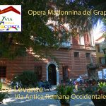
Sestri Levante: “Opera Madonnina del Grappa” (R) – Piazza Enrico Mauri, 1 (along the via Romana Occidentale) – notice is necessary – Credential obligator and identity card . contact phone+0390185457131 infocasa.fpm@gmail.com – the price for pilgrims: overnight stay € 15,00 € – dinner €10,00
Distances and reference marks:
Camogli-San Rocco km 1,500
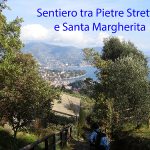
San Rocco-Pietre Strette km 2,700
Pietre Strette- Santa Margherita Ospedale km 3,150
Santa Margherita Ospedale –scaletta in Via Banchi km 1,000
scaletta in Via Banchi- Pagana uff. Postale km 1,200
Pagana-Ponte di Annibale Rapallo km 1,100
Ponte di Annibale- uscita del parco di Rapallo km 1,400
uscita Parco di Rapallo-Sant’Ambrogio Zoagli km 1,200
Sant’Ambrogio-San Pantaleo km 1,000
San Pantaleo-Piazza di Zoagli km 1,300
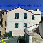
Piazza di Zoagli- San Pietro di Rovereto km 1,550
San Pietro di Rovereto- Santuario Madonna delle Grazie km 2,200
Sant.rio Madonna delle Grazie- Campeggio di Chiavari km 1,200
Campeggio di Chiavari-N.S. dell’Orto km 1,400
N.S.Dell’Orto- Ponte sull’Entella km 1,100
Ponte sull’Entella- Santo Stefano Lavagna km 1,100
Santo Stefano-Cancello n 4 e acquedotto km 0,650
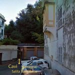
Cancello n 4- Cavi Salita ? km 2,900
Cavi- Ruderi San’Anna km 2,150
Ruderi Sant’Anna-Sestri Levante km 1,300
Totali km 31,100
Please report any problems or suggestions for improvement of the itinerary by writing to calsilvdc@gmail.com Thanks for your help.
The 12 proposed stages and described were been in the years by the authors that decline every responsability around possible changes on the territory that can alter how much it has described.


Questo articolo è disponibile anche in: