(GPS) 10 Sestri L. – Levanto
(Google Earth) 10 Sestri L. – Levanto
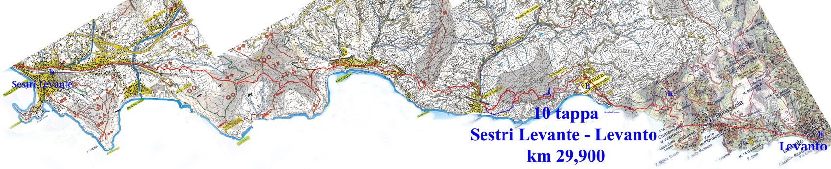
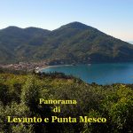
10 ° stage: Sestri Levante – Levanto 29,900km – Time: 7h30 – Difficulty: high
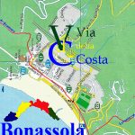
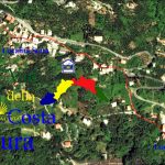
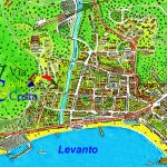
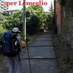
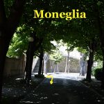
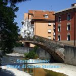
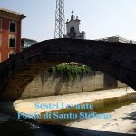
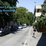
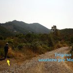
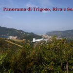
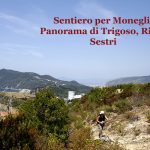
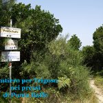
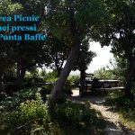
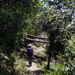
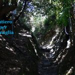
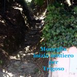
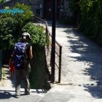
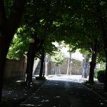
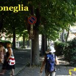
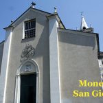
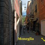
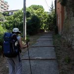
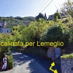
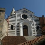
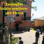
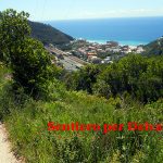
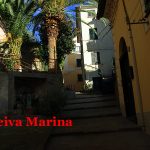
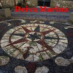
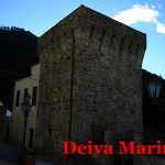
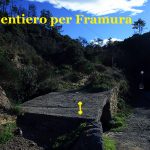
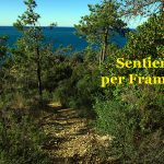
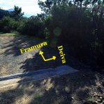
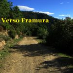
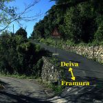
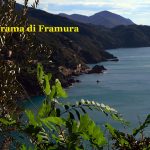
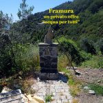
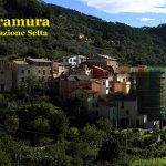
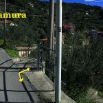
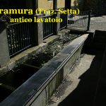
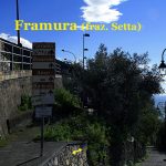
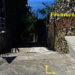
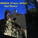
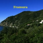
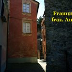
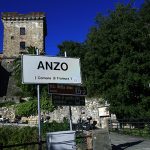
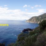
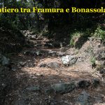
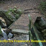
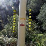
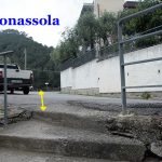
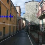
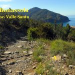
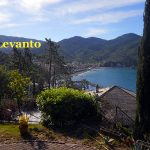
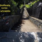
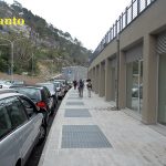
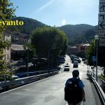
In Sestri Levante we go along the “Via Antica Romana Occidentale” for about 1,3km, turn right in Ponte S. Stefano Square; cross the river on the namesake Medieval Bridge (hidden between a house and a transition to a gallery which allows the access to the bridge); turn left in “Via Aurelia” and it is crossed, soon after we take “Via Antica Romana Orientale”, and then after a long stretch we enter again in “Via Aurelia” near the Banco di Chiavari ; at the roundabout take right towards La Spezia. We go through a long straight stretch and arrive at Trigoso. We continue on the right in “Via A. Gramsci” on the right skirting the railway; then at the traffic light we turn left into “Salita Villa Valle Lago” after that into “Villa della Manierta” (road-signs: two red crosses and red dot “Monte Comunaglia”), this road is partly narrow and paved and partly dirt road and finished the asphalt on a curve to the left take the dirt road with (road-sign: red dot on a iron pole). Immediately after to height of two red mailboxes we take the left the small path lined with small wooden stakes, at the open space continue uphill along a pink house,the trail continue to climb gently, then after steep back up the picnic area Punta Baffe. From here we take direction Moneglia: the trail is surrounded by luxuriant vegetation and it alternates with the most challenging points, with ups and downs, then definitely going downhill: (road-sign: dash/ red point). The last downhill for Moneglia starts from here, arriving at a villa’s surrounding walls we turn completely right on a path carved into the “tufo”. We turn left onto the asphalt road reaching “Via Venini”, then after having reached the hairpin with “Hotel Mondial” we turn left and continue for “Villa Edera” down a paved trail; to the cemented pole of Enel we turn left down on a stairway that reaches the tree.lined “Via A.G.Bollo”; arrived at the small playground area turn right and go through the tunnel to reach the cloister and the square of the church of S. Giorgio (fountain) of Moneglia.. (This section: Sestri L. – Moneglia is devoid of fountains, so supply with water). We then continue in “Via Roma”, “Piazza Marengo”, continue in “Via Vittorio Emanuele”, leads to the parish of Santa Croce (fountain) and continuig in “Via F. Romani”, we reach the railway viaduct, turn right into “Via delle Grazie”, cross the road and turn left over the small bridge in “Largo Don G. B. Rollo”. Then we take the stepped path uphill towards Lemeglio (road-signs: red square and blue full ball) to Deiva Marina. At the top of the road we take again the main road uphill to Lemeglio, at the restaurant “La Ruota” we climb a staircase to the right, reaching the village we pass through uphill and follow the (road-sign: red square). After passing the church turn left and we pass under an arch on bricked street, then turn right downhill on a dirt path. The first part is a latch on a slab path then we arrive at a crossroads and turn right to Deiva (road-sign: blue point). Going on downhill on dirt and then cemented road, reached to the first hauses of the village and next to a guard-rail turn right on “Via Mazzini” stairway (fountain): we are in Deiva. (Across the street, we walk along a small alley to the church of Santa Croce, the beautiful churchyard and the tower). Then we continue into “Via della Libertà” turning right, we cross the road, turn right along the river into “Corso Italia” and reached the bridge we turn left and cross it, then turn right, we pass under the railway, after a few meters turn left, then right again (*), after 50 meters (Loc. Fornaci) to enter the forest, turn left coasting along a mesh fence. Here starts the path to Framura (road-sign: SVA Framura); we climb up through the woods on a staircase carved into the rock, then the path runs along the ridge. We reach “ Serro places” near a house, pass it and just ahead we will reach a crossroads with several reports, we take the direction to Bonassola: here the trail becomes a gravel road the first flat, then downhill, bend against bend, and in correspondence of a pylon ENEL and a canaletta in cement that cuts the road, ( ) continue straight slightly downhill, after 1 km reached an explanatory panel upstream (**) we leave the road in front of downstream taking a path that continues diagonally in the wood without initial indication, the path continues with clearly visible (road-sign: two lines light blue and blue), but discontinued sometime by fallen trees that do not impede the way. Arrived on the asphalt ( ) we take the path that starts straight on the other side of the road; the path is short and steep downhill, it comes again on the road where there is another explanatory panel. We turn left down to arrive at the Stop sign, continue straight and after a long strectch of asphalt we reach and exceed an open space, we go to the right on a cemented path cross a washhouse and the church of San Rocco in Setta places. We continue in the village, right out the path we can see the imposing medioeval tower (fountain, food, bar and office JAT), we pass a bow and just after we descend the stairway and on the right there in the “Hostel Perla del Levante” (hospitality); we continue and cross Ravecca places (fountain), we reach the asphalt on a sharp bend with a picnic area, where we turn right to go down on a stairway in cement; reached the end of, turn left and cross Anzo places, then we pass on the bridge and follow the road downhill; to sharp bend to continue straight (road-sign: Vanderecca-Bonassola). We continue down and arrive in Ciamia places with picturesque harbor protected by a large rock with a Virgin Mary above. We are at Vanderecca places; over the asphalt will start the dirt path in the woods, at the fork take the path on the left: (road-sign: No. 1 with two blue waves), then we cross a bridge and continue uphill (road-sign: a little blue ball). We reach the “Poggio del Salice”(Bed and Breakfast), then the road becomes hardened and we get to an intersection where we take a small path on the right: the first part is level and then downhill. With a short climb we reach a unpaved little square on a bump, to our left there is a concrete light pole with road-sign: in blue for Bonassola: the road is unpaved and has two wide strips of concrete on the down-sides. At the crossroads we arrive on the main street: ”Via Carpeneggio” and then “Via Roma”, at the height of the garbage bins on the right you go down a staircase, you reach the end and on the right continue through a small porch, continue in a small square and then turn left in Via Risorgimento, at Bonassola, immediately after turn right in “Via Daneri”, travelled across all the narrow street and passed an arch you turn right in “Via Cristoforo Colombo” and after a few meters turn left on a path (G1 SVA road-sign: Levanto) uphill and partly stepped at “Via Poggio” (concrete stairs), cross the street and take the stairs, we come to a square with car park and immediately after that, on the left, we take again the stairs up with iron railing, we reach the paved road, cross bending left and go uphill to the restaurant “La Giulia” in “Via Scernio”, we cross it and resume the path with dark green pebbles to Levanto. At the gate go down stairs, avoiding the bends of the main road, at No. 16 of this road walk on stairs downhill to the sea, near a yellow building, then continue along the promenade to reach Levanto.
Variant: Loc Spiagetta – località Serro – confl, sentiero
(*) continue straight until we reach and turn to the left the ex railroad, arrived in “Località Spiaggetta” we take on the left the path with (road-sign: SVA 656) near a pink house. The path is clear visible and well wrought initially slight slope immersed in Mediterranean vegetation with a predominance of arbutus berries, the it does him very steep and it asks for attention to the exposure of the trip; almost at the top it returns less tiring and flows on a ample road excavated in correspondence of a “pylon ENEL” and a canaletta in cement that cuts the road, here we turn right slightly downhill on a dirt road ( )
Variant: paved road km 0,849
(**) after 1 km reached an explanatory panel upstream is exceeded and we continue in the plane of a dirt road to get to the paved road, turn right downhill and after a few turns we take a path on the left of the road that allows to trim the curve (road-sign: light blue arrow) ( )
Hospitality:
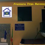
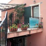
Framura – Loc. Ravecca: Nuovo Ostello “Perla del Levante” (L) – notice is necessary – Credential obligatory – contact phone +390187823035 – +393396109867 – info@perladellevanteframura.it – 27 seats bed – the price for the pilgrims equipped with Credential is € 24 + 1 city tax – including bed linen, towels and breakfast – restaurant service.
Bonassola – Fraz Montaretto: “Le scuole Nanni Scarrà” (L) – Via Del Campo, 14 – notice is necessary – Credential obligatory – apply Mrs. Katia e Silvia mob. tel: 0187814414+0390187814414 mob.+0393336950547 – price to be agreed.
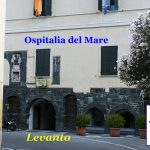
Levanto: “Ospitalia Del Mare” (L) – Via San Nicolò, 1 – notice is necessary – Credential obligatory – contact phone 0187802562 +0390187802562 fax +390187803696 ospitalia@libero. it www.ospitaliadelmare.it – 60 beds with blankets and sheets € 18/30 – including breakfast – 10% discount for pilgrims equipped with credential.
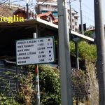
Distances and reference marks:
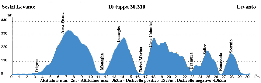
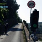
Sesrti L. – Semaforo di Trigoso km 3,700
Semaforo Trigoso – Area Picnic km 2,700
Are a Picnic – Moneglia km 5,200
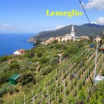
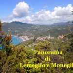
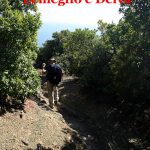
Moneglia – Lemeglio km 1,400
Lemeglio – Deiva M. km 3,000
Deiva M. – Loc. Fornaci km 0,900
Loc. Fornaci – Confl.Sentiero km 1,200
Confl.Sentiero – Pannello esplicativo km 1,100
Pannello esplicativo – stop km 0,600
Stop – Sentiero per Framura km 1,200
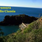
Sentiero per Framura . Loc Ciamia km 1,500
Loc Ciamia – Loc. Salice km 1,800
Loc. Salice – Bonassola km 1,800
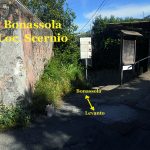
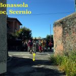
Bonassola – Loc. Scernio km 1,400
Loc. Scernio – Passeggiata Levanto km 1,600
Passeggiata Levanto – Levanto km 0,800
Totale km 29,900
Please report possible problems or proposals of improvement of the itinerary, writing to calsilvdc@gmail.com – Thanks for your help.
The 12 proposed stages and described were been in the years by the authors that decline every responsibility around possible changes on the territory that can alter how much it has described.

Questo articolo è disponibile anche in: